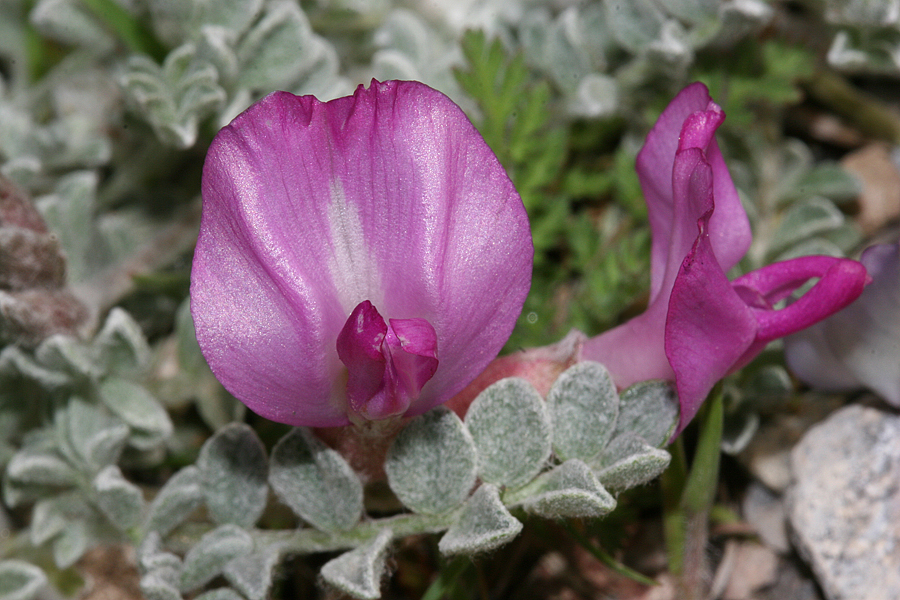
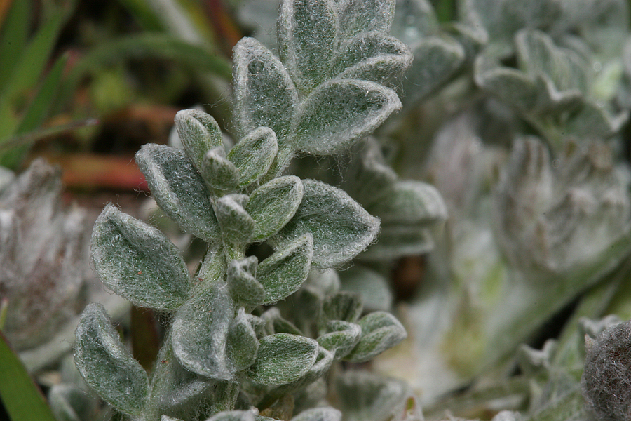
Goshen
Canyon, Utah County, Utah - April 08 2007
Goshen
Canyon, Utah County, Utah - April 08 2007
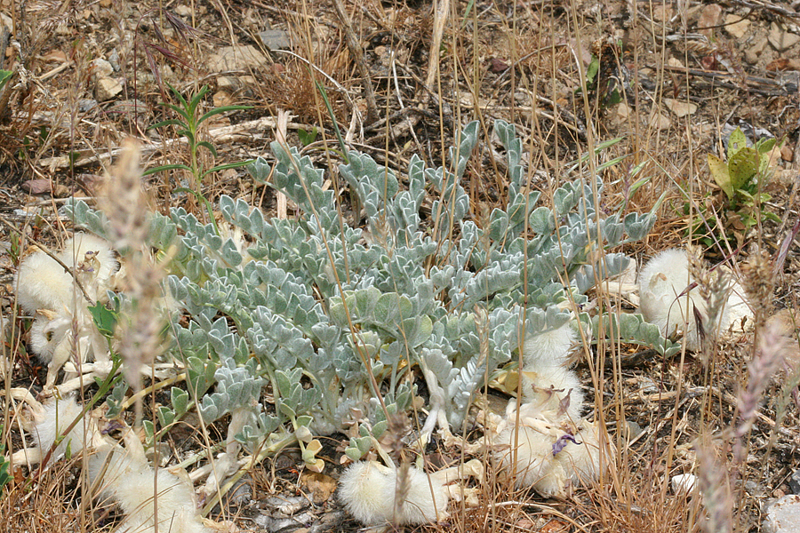
Butterfield
Canyon, Salt Lake County, Utah - June 05, 2007
Farmington
Canyon, Davis County, Utah- 30 July 2013
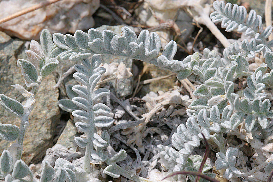
Farmington
Canyon, Davis County, Utah - 30 July 2013
Utahensis
at Blue Canyon, Tooele County, Utah -21 March 2014
Utahensis
at Blue Canyon, Tooele County, Utah -21 March 2014
Utahensis at Blue Canyon, Tooele County, Utah - 21 March 2014
No Flash, 1/200, aperature 7.1, ISO
400
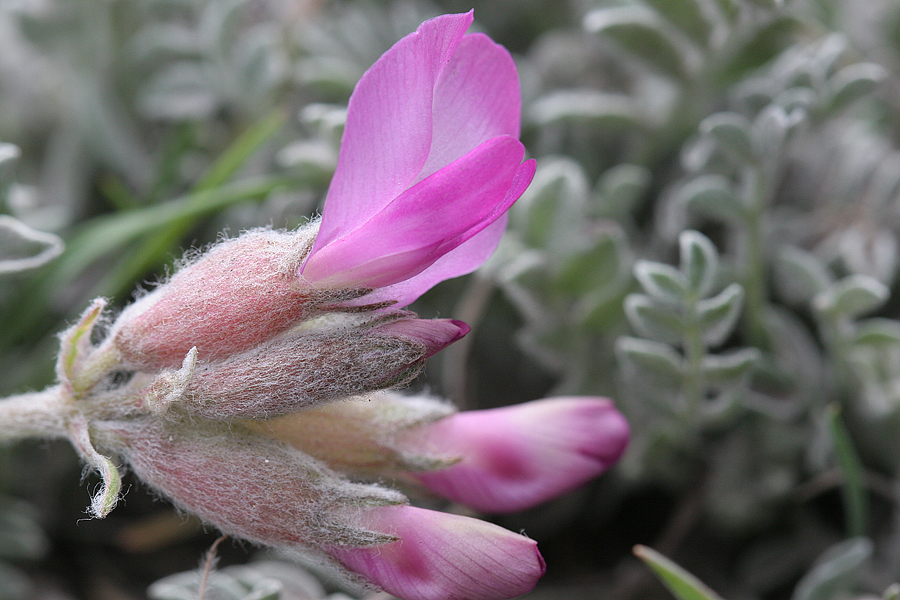
Photo Details - ©Nicky Davis
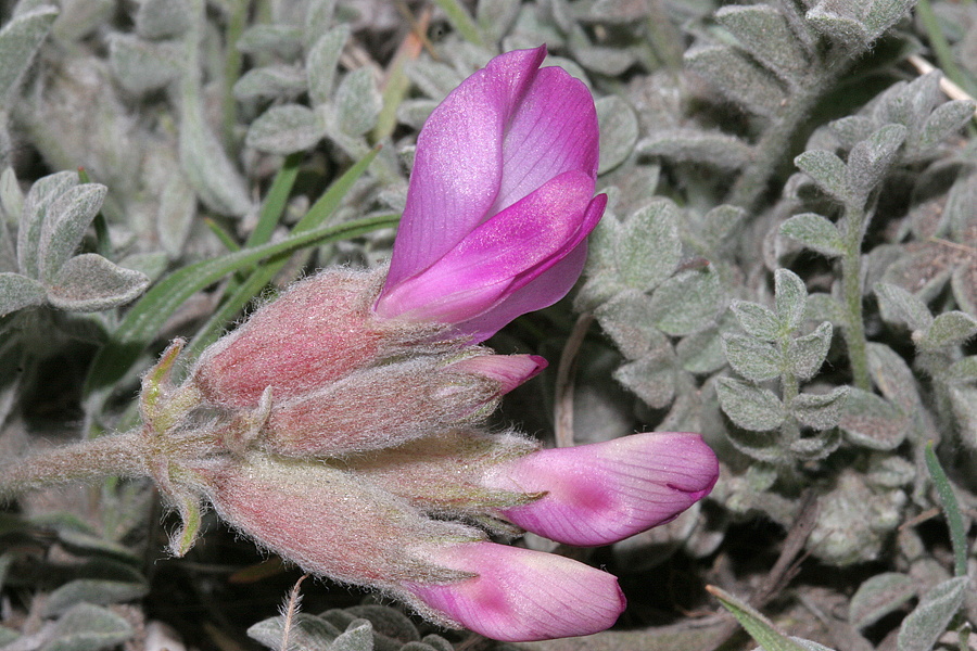
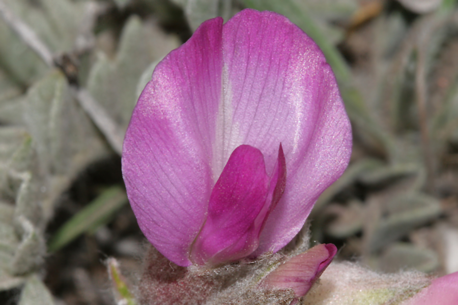
Flower and leaf photos taken
at Goshen Canyon, Utah County, Utah April 08, 2007 - elevation
4760 feet
39° 53' 58" N, 111°53' 21" W
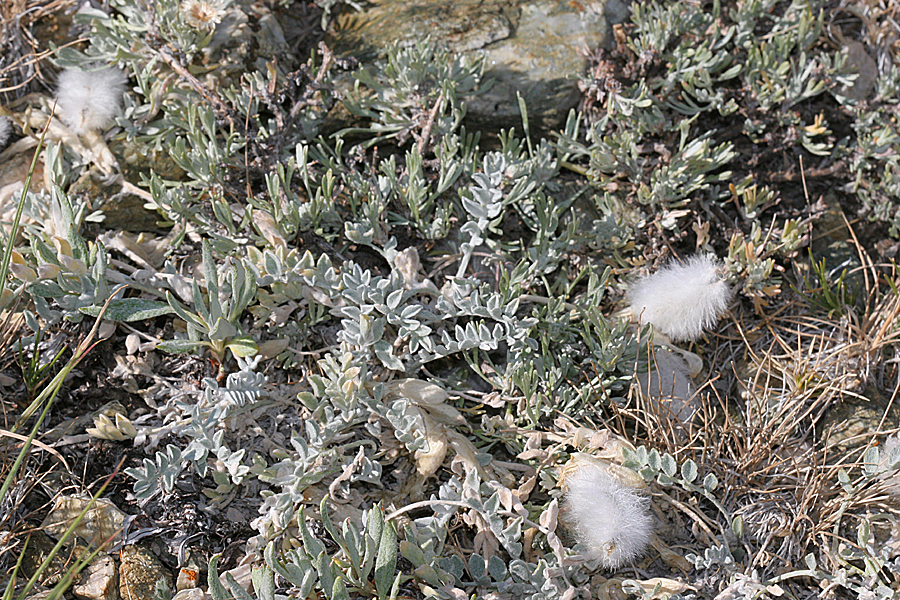
Plant with white, woolly seed pods, legumes, photo was taken June 05, 2007
at Butterfield Canyon, Salt Lake County, Utah.
Plant located at Farmington Canyon, Davis County, Utah- 30 July 2013
Plant located at entrance to Blue Canyon, Tooele County, Utah- N. 40.34361,
W. -112.60306, elevation 5830 feet, 21 March 2014 - (last photo- no
flash, 1/200, aperature 7.1, ISO 400)
Plant not yet flowering was located near first BLM Parking lot at Stansbury
Island, Davis County, Utah, March 5, 2014
Plant not yet flowering was located near parking lot of trail to Rock Canyon,
Utah County, Utah 23 March 2014
A field of flowering Astragalus utahensis was located at Highland
Drive and Bangerter Highway, 27 April 2014
Characteristics
Perennial, native, blooms April., pubescence covers top
and bottom of the compound, pinnate leaves. Seed pods are covered
in white woolly hairs.
Other Locations
"Utah Valley University Herbarium"
http://herbarium.uvu.edu/virtual/
1. Utah Highway 89 ca 1 mile North of Birdseye, East side of Highway,
across from white church. Elevation 5345 ft, in volcanic ash derived
soil, erosional surface.
2. Provo, Rock Canyon. 40° 16'56" N. 111°38' 7" W.
3.
Provo, Rock Canyon Park, steep gravel covered slope, first bench in mountain
gambel oak vegetation,
40° 16' 4" N. 111°33'34"
4. Mouth of Provo Canyon across from Power Plant
5. Rocky hillside at Mantua Reservoir 5900 ft. Box Elder County, Utah
6. Bountiful Canyon, Davis County, Utah 40° 53' 25" N, 111°
42' 39" W
7. South side of the road that heads up to Rock Canyon, 1 mile before
entering canyon. 40° 11' 43" N, 111° 35' 50"W
8. 2 miles east of Meadow, Millard County, Utah 38°
53' 7" N, 112° 24' 13" W
9. Squaw Peak overlook, Utah County, Utah
10. West Mountain, elevation 4822 ft. 40° 1' 57" N,
111° 48' 25"
11. Highway 12 and Mt. Nebo Scenic Loop, rocky, sunny hillside
12. Payson Canyon, Maple Lake turnoff, 39° 55' 52" N, 111°42'1"
W
13. Battlecreek Canyon, Utah County, Utah 40° 22' 9" N, 111°
42' 39" W
14. Head of the Middle Desert, Wayne County, Utah 38° 21' 41" N,
111° 2' '7" W
15. Painter Spring, elevation 5366 ft., 39° 11' 12.73" N,
39° 26' 45.34" W
16. Stansbury Island, West slopes, Tooele County, Utah

|
|